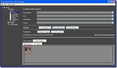
Microsoft just released version 1 of their Pro Photo Tools (genuine advantage and .net framework 3 required) that allows you to geotag your photos. Interestingly the software seems to think it is called Photo Info v2 as trying to install it popped up a message saying I needed to remove Photo Info version 1 before installing version2. Having got that hurdle out of the way I loaded the software. I was pleased straight away as this application loaded a lot faster than photo info v1 which could take about 45 seconds to load but at first glance I shuddered at the dark grey colour scheme but then continued to click around the application. I loaded a photo I had already geotagged and sure enough the information was displayed in the gps fields and on the map. One cool feature is the “Get Location Text” button that gets the street address from the co-ordinates – very cool. The application also allows you to load in a gpx file (or other location files) from your gps and automatically sync the location with the time stamp from the camera. I haven’t tried this yet as I don’t have a recent gps log with photos – I’ll have to go out geocaching some more to rectify this! If your camera time is slightly off (I just realised mine is an hour slow due to the time change) you can change the time stamp on all of your photos basing the original time on gps time or exif time.
I finally stamped a whole load of photos with my name, website and description of the event and quickly saved all the information back to the files. Keywords can be entered to tag the photos but need to be comma separated (the software doesn’t tell you that and space separating them puts them all in as one long keyword.) It was handy to have the photos open in Windows Live Photo to view the keywords as the files were changed to see how this would work. No changes in WLP were necessary – as the files were saved the tags were changing in real time.
I’d really like to be able to create macros in this application to automatically stamp my data into photos such as Photographer, url etc as at the moment its a process taking a few steps – not many, but it would be nice to automate it. Also the ability to select various copyright choices such as creative commons would be good too (it defaults to all rights reserved).
Overall a nice package to be added to my existing set of photo editing tools – it will probably replace wwmx as my geotagging tool of choice.
